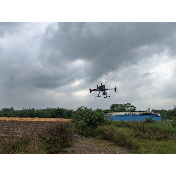
Aerial 3D Laser Scanning System For Real 3D And Smart Mining
With the design concept of tight integration, the system highly integrates multiple sensors such as laser sensor, GNSS, high-precision IMU, professional metric camera, etc., which can be seamlessly compatible with DJI M300 RTK with an integrated control unit from DJI. The system brings customers a simple aerial survey experience with fully detailed 3D terrain data.
Product Introduction
Product Specification
| SYSTEM PARAMETER | Weight | 960g |
| Dimension | L150×W105×D121mm |
| Average Power Consumption | 30W |
| Power Supply | 12 ~ 30V DC |
| Device Interface | DJI Skyport/other interface available upon request |
| Data Storage | 256GB TF Card |
| Operating Temperature | -10℃ ~ 50℃ |
| StorageTemperature | -30℃ ~ 60℃ |
| System Accuracy | 5cm |
| Operation Duration | 33min@M300 RTK UAV |
| Compatible Platform | DJI M300 RTK/Other UAV models |
| LASER SCANNING UNIT | Laser Class | Class I |
| Wavelength | 905nm |
| Measurement Range | 100m@15% / 180m@35% / 300m@90% |
| Ranging Accuracy | 0.5cm |
| Horizontal FoV | 360° |
| Vertical FoV | 40.3°( -20.8° ~ +19.5°) |
| Scanning Point Frequency | Single Echo: 640000pts/s,
Dual Echo: 1280000pts/s,
Triple Echo: 1920000pts/s |
| Echo Mode | Single Echo/Dual Echo/Triple Echo |
| IMU | GNSS Signal Tracking | BDS,GPS,GLONASS,GALILEO |
| Positioning Accuracy(Post-processing) | Plane:1cm / Elevation:2cm |
| Position Data Rate | 5HZ |
| Attitude Accuracy(Post-processing) | heading: 0.04° / pitch /roll: 0.008 ° |
| Attitude Data Rate | 200HZ |
AERIAL CAMERA
(BUILT-IN) | Effective Pixels | 26MP |
| Sensor Dimension | 23.5×15.7mm |
| Image Resolution | 6252×4168 |
| Image Width FoV | 73° |
| GSD | 2.3cm@100m Flight Height |
Features
Ultra long endurance
the innovative design of the system makes the whole scanner smaller in size and only 960g in weight, which can effectively extend the flight time in the air.
Ultra-high precision
with the unique intelligent algorithm, the massive 3D point cloud obtained can achieve professional-level measurement accuracy.
Extremely integrated
seamless compatible with DJI M300 RTK, the system is designed for unprofessional users, through simple plug and play, the user can control and monitor the whole system by using integrated Apps in DJI’s control unit; the data is well organized to be stored, with a simple one -click, the data can be downloaded locally.
Real-time monitoring
the real-time flight trajectory, 3D point cloud, and aerial view images can be
transmitted back and displayed in DJI’s control unit in order to help the user to evaluate the system in the air in real time.
Applications
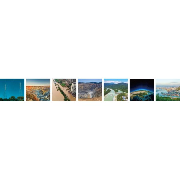
Smart Grid Topographic Emergency Smart Water Conservancy Nature Real 3D
Survey Rescue Mining &Hydrology Resource
Accessories
Case
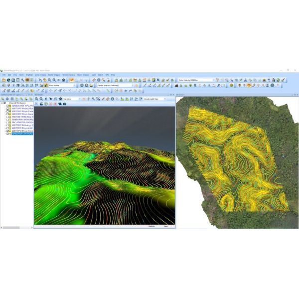
EasyScan W30 was applied to measure the River Survey in China
Sample Data Display
Product Tags:

|
|
UAV LiDAR System For Real 3D And Smart Mining Easy Scan W30 Images
|